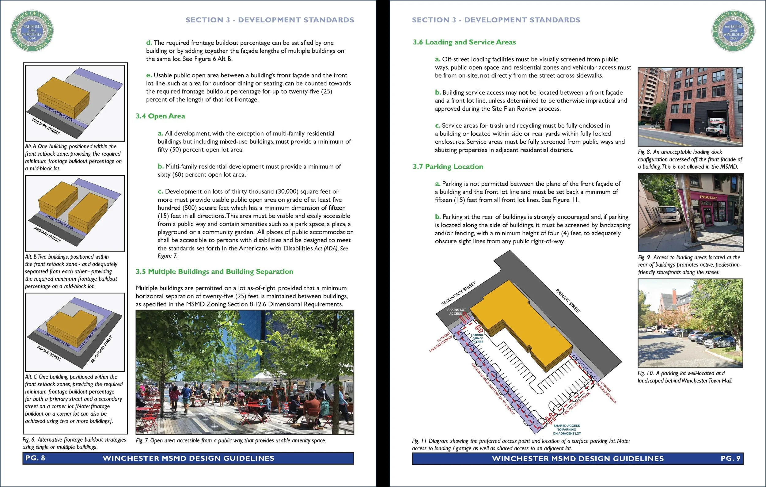
Nantasket Beach Redevelopment Area: Masterplan + Urban Renewal Plan Update
Urban Design

Hull Redevelopment Area
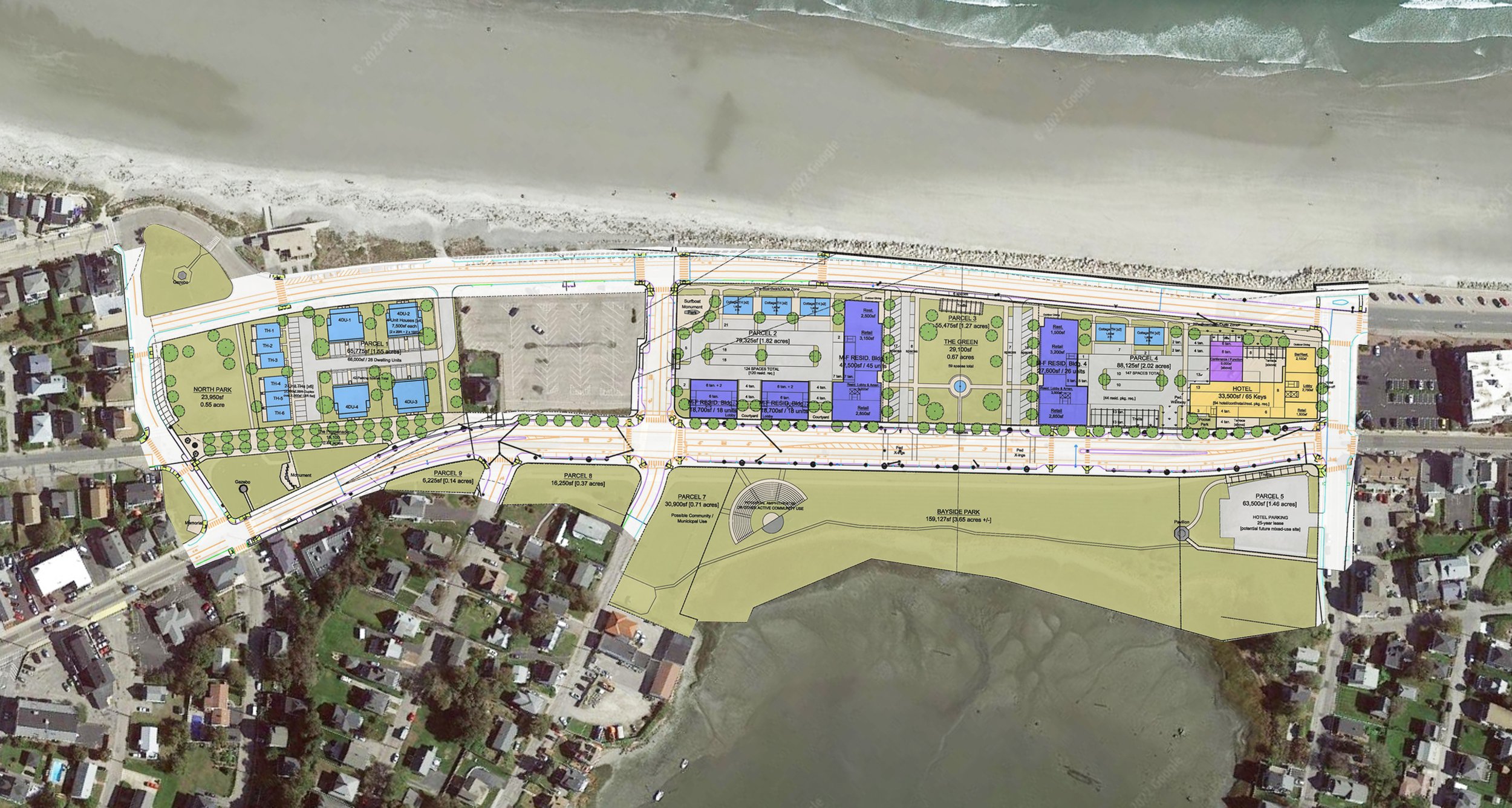
The Nantasket Beach Redevelopment Area is located on a site with a rich history as a seaside entertainment destination. Vacant for years, redevelopment of the 15-acre site has the opportunity to knit together distinct neighborhoods, serve as a gateway to the community and ensure the appreciation of natural and cultural resources. Form + Place’s recent masterplan study, produced in conjunction with TEC and the Hull Redevelopment Authority [HRA], is part of an Urban Renewal Plan update and an effort to define the parameters for contextually sensitive private development.
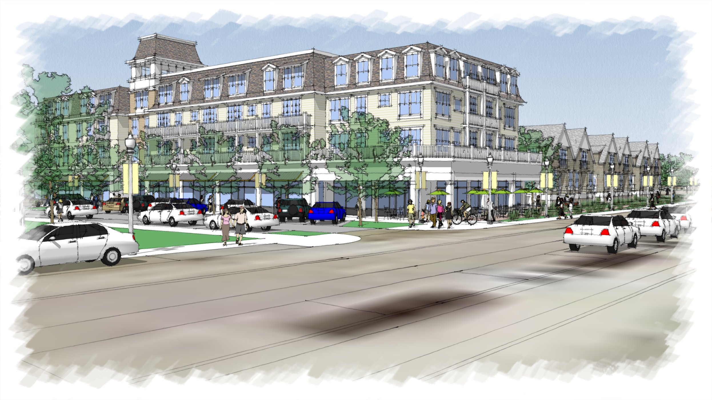
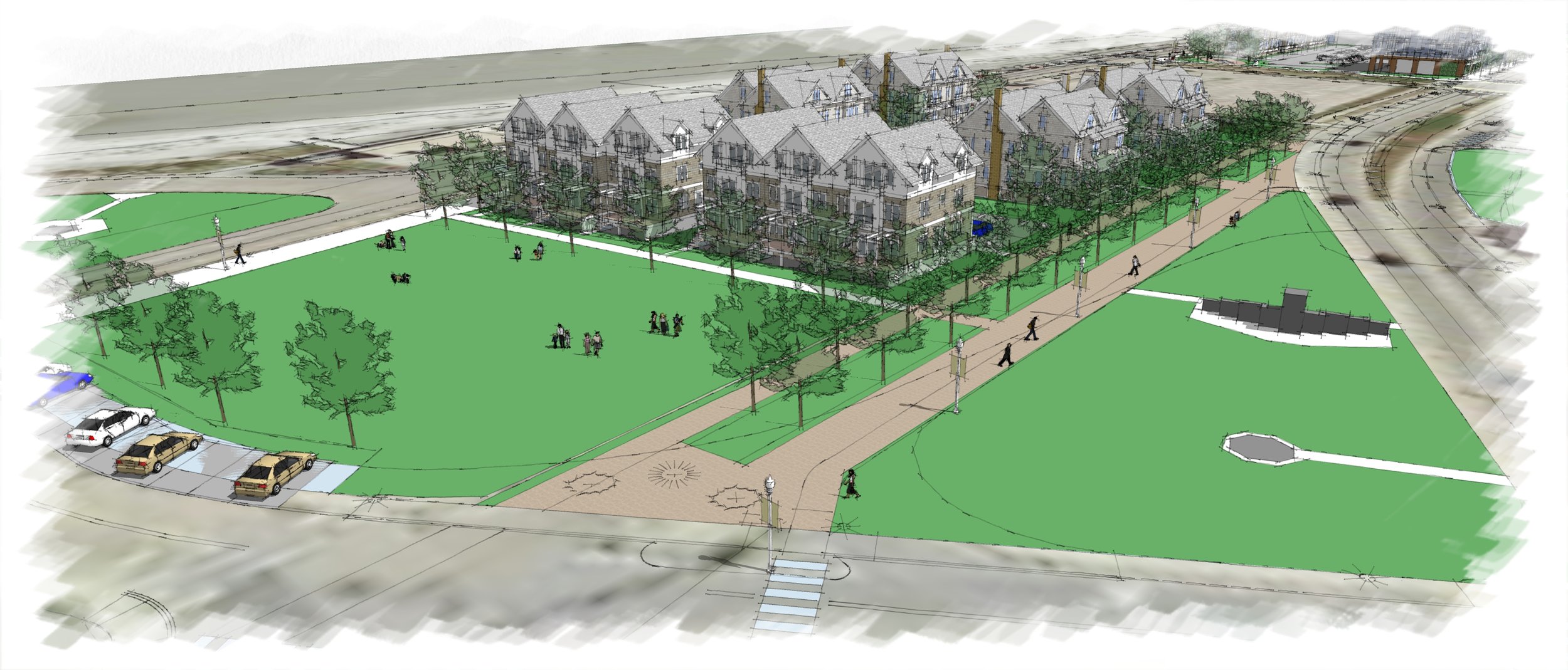
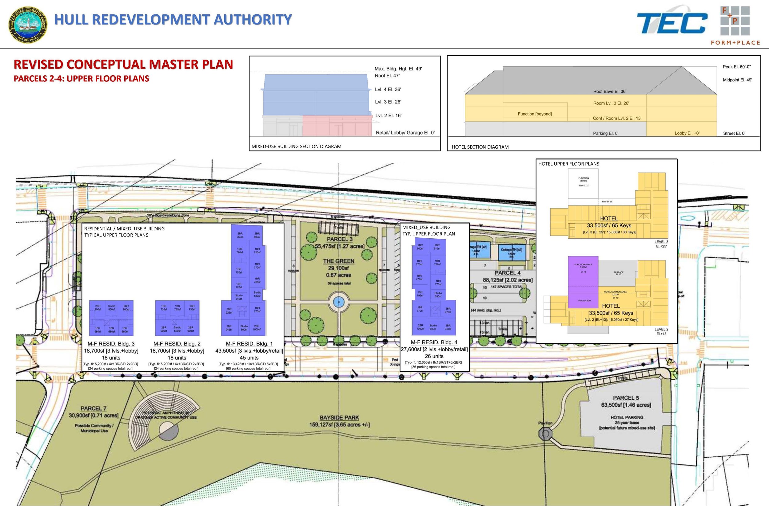
Organized around a central “green”, purposefully situated to provide a community focal point and maintain an important visual connection between the ocean and bay sides of the peninsula, the 230,000sf mixed-use masterplan includes ground floor retail and restaurant spaces plus a hotel and conference center. A variety of housing typologies, ranging from townhouses to 4-unit dwellings to larger mixed-use multi-family buildings, are integrated in order to appropriately transition in scale to the abutting neighborhoods.
The redevelopment of the site will be a model for storm “resiliency” and must be able to withstand the challenges of sea level rise. Form + Place’s study has served to test the Design Guidelines currently in place in the Overlay District and illustrate, for the HRA, how the goals of resilient design and contextual development - scale, architectural vernacular and walkability - that is compatible with the surrounding Hull context can both be achieved.